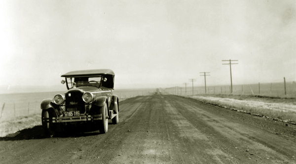
"Oiled" Highway between Laramie and Bosler, approx. 1926.
Eighteen miles to the northwest of Laramie is Bosler. In 1914 the highway west of Laramie was described by Motor Age Magazine,
May 7, 1914, as "as had considerable improvements made and some very expensive bridges at Bosler
across the Larmmle river and across the Rock river have been put in."
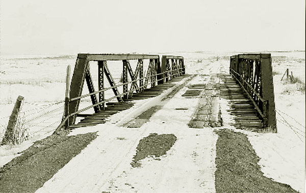
Bridge that formerly crossed the Laramie River on Lincoln Highway.
The Bridge was moved to county road 740 about 1932 but is still in use.
Just how good the
highway was in 1914 is, as indicated by the following photo, somewhat debatable.
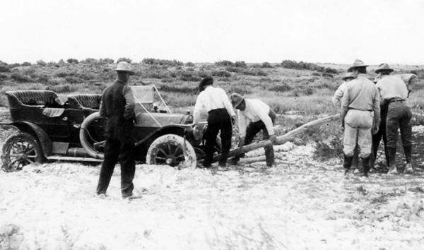
Vehicle north of Laramie, approx. 1915
Road conditions to a great
extent are dictated by the equipment available for road construction. The horse-drawn
grader depicted below was not atypical.
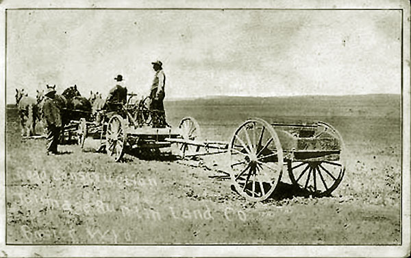
Horse grader at Bosler
The above photo was a promotional postcard by the
Tallmadge-Buntin Company to indicate what strides they were making in their
development of the area. For photos and discussion of the Tallmadge-Buntin Company, see
Tallmadge-Buntin.
By 1924, the Lincoln Highway Association described the road from Laramie to Bosler as being a
"good gravel" road. Bosler, itself, with a population of 75, was described as:
"One railroad crossing at grade, not protected. One Railroad,
3 general business places, express company, telephone, one newspaper,
two public schools. Good hunting and fishing. Camp site."
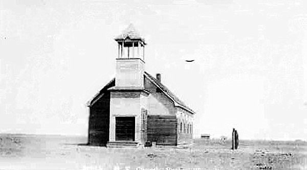
Methodist-Episcopal Church, Bosler, undated.
The townsite of Bosler had been a part of the Bosler Ranch which had been acquired by Ora Haley. For
discussion of Haley, see Brown's Hole.
The Bosler Ranch was originally owned by the Bosler Brothers and later Frank C. Bosler and John Coble and served as
a home-away-from-home for the infamous Tom Horn. but was licquidated about 1904 following a bitter dispute between
Bosler and Coble arising out of Coble's expenditure of funds in the unsuccessful defense of murder charges brought against Horn. See
Tom Horn.
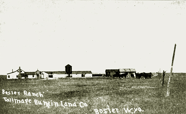
, Bosler Ranch, 1908.
In 1908,
Tallmadge and Buntin acquired some 60,000 acres including the Bosler Ranch and the Oasis Ranch which
included the area of Wyomming Station, a former Union Pacific Railway station about eight miles north
of Laramie. The purchase was a part of a real estate and irrigation
project. See Laramie Boomerang, April 23, 1908, p. 1, and the Laramie Republican April 30, 1908, p. 1. The
purchase was touted by the Republican, August 15, 1909, as the largest real estate
transaction ever recorded in the State of Wyoming.
Before Tallmadge and Buntin's purchase, Rand-McNally's 1903, "Guide" p. 90 to the Overland Route, regarded Bosler, along with other stations on the Union Pacific of Bona, Howell, Wyoming [Station], and Cooper between Laramie and
Medicine Bow as "unimportant stations." At one time Wyoming Station and Cooper had served as loading points for railway ties.
Wyoming Station, approximately 12 miles north of Laramie, was established with the original construction of the railway as an important point for freighting of goods along the Little Laramie, Centennial and Keystone. By the
but by the 1880 census it had a population of 46 "farm Loborers" [cowboys] amd 1 carpemter. In 1898,
Ora Haley attempted to change the name of Wyoming Station to "Oasis." See
Daily Boomerang, November 11, 1898, p. 3. By the time the Lincoln
Highway was designated, only the foundation stones of the section house and depot remained. Gone were the water tank, the Hall and France store, and a
saloon which the Episcopal Church converted into a church. It remained, however, as
landmark for the Goodrich Tour Cards directions from Laramie to Rawlins.
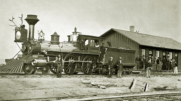
,Locomotive 23 at Wyoming Station 1868. Photo by A. J. Russell.
In Bosler, plans to provide irrigation by means of canals proved to be a failure. By 1912, bonds used to finance the improvement of irrigation
went into default and most of the settlers had left. See Financial World, November 30, 1912, p. 24.
Like the mouse in Robert Burn's 1785 Ode to a Mouse that in anticipation of winter
constructed her winter nest, safe and snug, only to have it destroyed by a plough,
Tallmadge and Buntin's best laid plans "gang aft agley."
But, Mousie, thou art no thy-lane,
In proving foresight may be vain;
The best-laid schemes o' mice an' men
Gang aft agley,
An' lea'e us nought but grief an' pain,
For promis'd joy!
Put into
modern legalese by the Wyoming Supreme Court:
The defendant irrigation district seems to be one of those unfortunate
districts in which there is an extremely limited water supply. In the
western part of the district, west of the Big Laramie River, is
located a reservoir, by which, in the early days, it was doubtless
hoped that a supplemental water supply could be obtained amply sufficient
to irrigate all the lands in the district. But whatever may have been
true in the beginning, the hope was not realized, and the apparent
purpose of organizing the district appears to have been entirely
frustrated. By reason of drouth very little water has for many
years been available for irrigation.Biddick v. Laramie Valley Municipal Irrigation District, &6 Wyo 67, 299 P. 2d 1059 (1956)
Next: Bosler and Rock River.
|