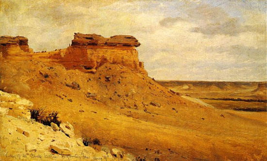
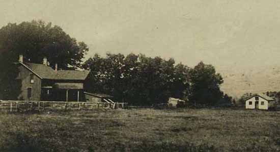
Valley of the Chugwater, Sanford Robinson Gifford, 1870.
In 1870, on a side trip, the Hayden Expedition passed through the valley of the Chug, Accompanying the expedition was
artist Sanford Robinson Gifford (1823-1880). Gifford was an artist of the "Hudson River School." His practice was to
work in his sketch book and then complete the painting later.
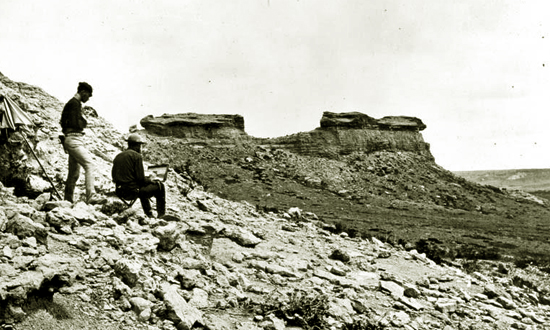
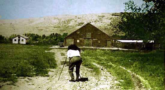
Sanford Robinson Gifford sketching Valley of the Chugwater. Photo by William Henry Jackson,
1870.
At the time, the
cattle industry in Wyoming was only in its infancy. Professor Larson notes that in 1870 there were but 8,140 cattle in the entire
territory. Nevertheless, Hayden's photographer, William Henry Jackson, in his description of the valley, noted that it was
already a wintering area for cattle:
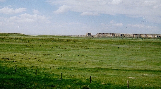
A very conspicuous feature which we notice in descending the valley of the
Chug is the high bluff of Lower Cretacious sandstone, which stretches away toward the
northeast like a hugh wall. the jointage is so regular that it presents
the apearance of massive mason-work gradually falling to decay. The sides of these
sandstone walls are from 40 to 60 feet perpendicular, sometimes overhanging, large
masses of which have broken off and fallen to the base. Their most striking feature, however is to weather
into most picturesque castlllated forms. The valley of the Chug is 100 miles long, and
is a favorite place to winter stock."
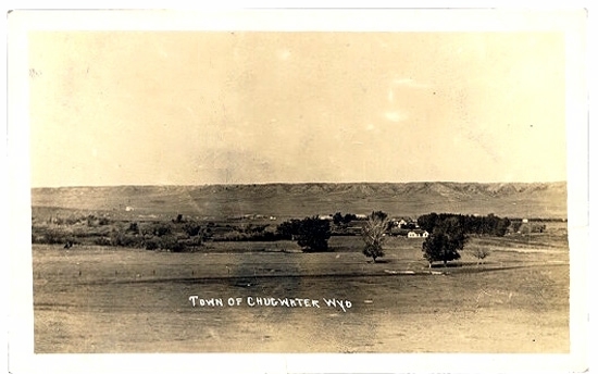
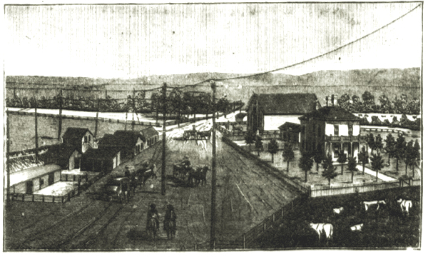
Chugwater, 1913
Cattle were allegedly first wintered over in the valley as early as 1859. The town of
Chugwater, itself, is named after Chugwater Creek. The area, however, due
to its proximity to Fort Laramie, had been explored in the early
expeditions, including that of Stephen Watts Kearny in 1845. Thus, William B. Franklin's map accompanying
Kearny's report shows the Chugwater, although spelling it as "Chagwater."
The popular version of how Chugwater received its name is that the word "Chug" is an onomatopoeic version of
the sound of a bison hitting the ground from an Indian buffalo jump.
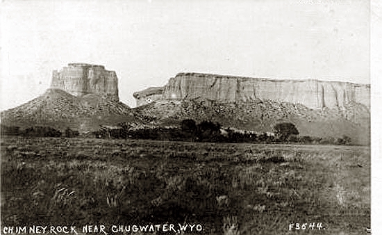
Chimney Rock north of Chugwater, 1914
Another version that "chug" took its name from Chimney Rock several miles to the north of
Chugwater was put forth by Rufus B. Sage (1817-1893) in his 1846 book,
"Rocky Mountain Life; or, startling scenes and perilous adventures in the Far West during an expedition of three years",
Boston, Thayer & Eldridge, 1859 ed. Sage describes the Chugwater:
Several miles above the Fort [Fort Platte] we crossed the Chugwater, a large affluent of the
Laramie, from the right. This creek takes its rise in a wild and desolate section
of the Black Hills, near the head of Horse creek.
Thirty miles or more of its way is traced trhough a dreary wilderness of rock, sand, and
clay, almost entirely devoid of vegetation.
This region, it is said, affords gold; and, indeed, I have received frequent
assurances that this valuable metal has been procured, in small particles,
from among the sand of the creek-bed.
This region also claims many natural curiosities, of which I may take occasion to speak
more particularly hereafter; -- one, however, situated upon Chugwater, here
seems more appropriately to demand a passing notice.
It consists of a columnar elevation of sandstone and marl, towering aloft to
the height of several hundred feet, like the lone chimney of some ruined mansion, --
standing as the melancholy monument of the ruins that surround it.
This singular pile of rock and earth is nearly of a quadrangular form quite
regular in its structure, and compares very nearly with the "Chimney" below Scot's
Bluff, in its general outlines. it stands within a short distance of the east
bank of the Chugwater, and gives the creek its present name.
The statement is then footnoted: "The word 'Chug' implies chimney; of the derivation of the
term, however, I am ignorant."
Chimney Rock, Photo by Geoff Dobson.
[Writer's note: The chimney of which Sage writes is probably "Chimney Rock" north of
Chugwater and about a mile south of Slater. Fort Platte was a rival trading post to Fort Laramie, located
about a mile upstream from Fort Laramie.]
The first settler in the valley was James Bordeaux (1814-1878), who in 1868 constructed a store at the point where the
road from Cheyenne split, one road leading to Fort Fetterman and the other to Fort Laramie. Bordeaux was born in St. Charles, Missouri.
By age of 15 he was working for the American Fur Company at Ft. Union and two years later he was
employed by William Sublette as a boatman. After the military purchased Fort Laramie, Bordeaux, established
a trading post several miles from the fort. Other early settlers included the scout Baptiste "Big Bat" Pourier, John Baptiste
Richard who settled near present day Bordeaux, John Hunton, Charles Clay, and Hirem B. Kelly.
Both Hunton's and Clay's original houses were described by early bullwhacker, William Francis Hooker, in his 1918
The Prairie Schooner as log structures, loaded with firearms looking like armories. Gun ports were
at shoulder height. Clay's house was located beneath Chimney Rock and Hunton's was where the road to Eagle's Nest split off.
John Hunton's Ranch, Bordeaux, 1884.
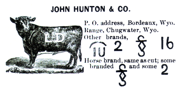
John Hunton's Brands, 1884.
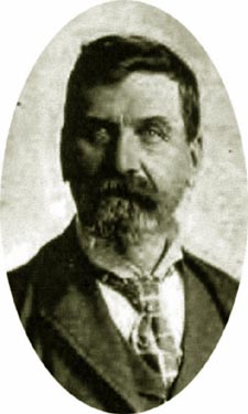
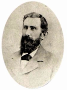 John Hunton
In 1922, Hunton wrote in the Second Biennial Report of the State Historian of
the coming of cattle to the Chugwater:
The Quartermaster Department U.S.A. at that time [1870] carried the mail
between Fort Laramie and Cheyenne once a week each way, taking four days to make the round trip. After Hunton bough the ranch
[the Coffey and Cuny Road Ranch] the Fort Laramie Quartermaster established
a stage or mail station, built quarters and a stable and kept a detachment of
eight soldiers there for about two years. In 1869 (late fall) the
Indians were so troublesome on the Laramie river west of Fort Laramie that Benjamin B.
Mills and William G. Bullock moved their herd, about 150 stock cattle, from the
Laramie river valley to about five miles above Chugwater station on the Chugwater
creek, and in April, 1870, moved them back down creek to the mouth of the Richard
(pronounced Reishaw) creek, where about the last of April the camp was attacked by Sioux Indians and
entirely destroyed. There were two herders John Boyed and William Aug, who had been out off their
boots and laid down to rest when the Indians fired their guns thru the tent and charged the
camp. the herders grapped their guns, ran from the tent and jumped into Chugwater creek,
being both barefooted. They followed the bed of the creek for nearly ten miles. the Indians fired a
few shots at Boyed just above Chimney Rock. After this the herders moved to the
Bordeaux ranch and the herders located there.
In 1871 Mills died and Hunton then bought his half interst in the
herd, which was the first herd of stock cattle located on
Chugwater creek.
Kelly Ranch, Chugwater, 1880's
Hirem Kelly at first resided in
a log and sod house until replaced by a large brick house. Nearby he maintained a
jail built of grout which occasionly housed road agents.
Kelly Ranch, Chugwater, 1880's
Kelly maintained a stop for travellers. Laura
Winthrop Johnson, "Eight Hundred Miles in an Ambulance," Lippincott's
Magazine of Popular Literature and Science, June 1875, described Kelly:
 H. B. Kelly
|
Still on the ambulances rolled, over the hot, high table-land, till about
five o'clock we saw some strange yellow bluffs before us, and descended
into the valley of the Chug, a clear stream flowing through a fringe of
willow, box-elder (a species of maple) and the cottonwood poplar. Here was
Kelly's Ranch, a large one, close by which we were to camp for the night.
We found there Lieutenant F—— and an escort of twenty horse, which had been
sent to meet us from Fort Laramie. They had our tents pitched for us, and
everything ready. A wild, lonely place was this green valley, with its
fantastic waterworn bluffs that bore a grotesque resemblance to turtles,
seals and other great sea-beasts, and it was delightful to see trees again
and to hear the sound of running water. The children at once pulled off
shoes and stockings and began to paddle in the stream, and some of the
elders followed. It was arranged that we should have supper and breakfast
in the ranch, which was a sort of tavern, and we found the supper quite
good enough for hungry people, despite the odor of onions that pervades
the hearths and homes of this region.
Kelly was a tall, dark, slender man, with large melancholy eyes, soft,
but never meeting you quite frankly—eyes into which you could not look
very far. It is not easy for us to understand the life of this man and
his "pard," with their Indian wives and half-breed children, fifty miles
from anywhere; yet they seemed very busy and comfortable. He was asked
how he liked it. "It's rather lonesome," he replied. He was a man of few
words, and went about silently in carpet slippers, waiting on us at table.
No one else appeared, but we had glimpses of the Indian women in the
kitchen preparing the meal.
In 1884, Kelly travelled
to Scotland and sold his ranch to the Swan Land and Cattle Co. and with the proceeds moved
to Cheyenne.
Chugwater as a town, however, owes its existence to two events, the coming of the
Swan Land and Cattle Co., discussed on the next page, and the coming of the railraod.
Of the two, the cattle company was of the greater importance.
In 1886, with the assistance of the
Legislature, Philip Dater, William W. Corlett, Erasmus Nagle, F. E. Warren, Thomas Sturgis, and Henry G. Hay, chartered
the Chyenne and Northern Railroad. The incorporators were certainly not without political influence.
Warren was territorial governor, Nagle a leading merchant, and Dater, a stockgrower, was the
first president of the Cheyenne Club. It was the intent that the railroad was to extend all the
way to northern Wyoming, cross Montana, and reach British North America. Unforturnately, for the
investors they lost the race to reach Douglas to the Fremont, Elkhorn and Missouri Valley.
Construction was abandoned at Wendover on the North Platte. Thus, the railroad was sold
to the Union Pacific which extended the tracks to a connection with the F. E. and M. V. at Orin.
The Union Pacific combined it with other snippets of railroads it owned in Colorado and Texas making it
a part of the Union Pacific, Denver and Gulf Railroad. With the receivership of the Union Pacific in 1890,
the road was sold becoming a part of the Colorado & Southern, now a part of the
Burlington System.
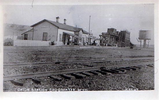
Union Station, Chugwater, 1914.
Photo courtesy of Brian Dunlop.
Next page, Chugwater Continued, the Two Bar.
|