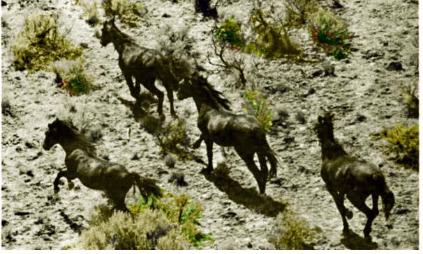
Wild Horses, Red Desert near Adobe Town, 1983
One of the primary locations for wild horses in Wyoming is the Red Desert lying between Rawlins and Rock Springs. On the western edge is the
north of Wamsutter and south of Tipton made famous by Butch Cassidy and his gang is Laney rim, sometime
called Delaney Rim, an escarpment possibly named after an early rancher William Laney who proved up his homestead in 1891.
At the foot of the Rim are Laney Springs. There is also a Laney Draw. Along the foot of
Laney Rim arises Bitter Creek which ultimately flows into the Green River. South of the Interstate Highway is an
area called "Adobe Town." It is, of course, not a town, but an area of rock pillars, hoodoos, draws, and box canyons, appearing at a distance
much like pink mud South Florida condominiums. At one time much of the area was a lake dating to the Paleocene Epoch some
56 to 66 milion years ago. The lake was inhabited by alligators and crocodiles. The lake and the alligators and crocodiles have disappeared leaving behind
an alkaline basin.
On the south end of the desert is an area which aptly describe the area, Desolation Flats.
North of Rock Springs and east of Eden, an early dry farming real estate promotion, lies Killpecker Dunes the largest active
dune area in the United States. The dunes apparently take their name from
Killpecker Creek. For discussion of the naming of Killpecker Creek see
Rock Springs.
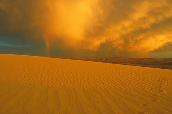
Killpecker Dunes. Bureau of Land Management Photo.
Until the late 19th Century, the area remained essentially unexplored except perhaps by outlaws, until Professor Aven Nelson (1859-1952),
entered the area to determine whether the
area was suitable for grazing. See Nelson, Aven: "The Red Desert of Wyoming
and its Forage Resources," U. S. Department of Agriculture. Division of Agrostology, Washington, 1898. Dr. Nelson later served as
acting president of the University of Wyoming (1917-1922). As to the area's suitablility for
forage, Dr. Nelson concluded:
The larger Red Desert as now understood includes, however, all that arid section of salt-impregnated soil in southern Wyoming, in which the salt-sages
predominate, and which, on account of the absence of suitable stock water, can only
be used for winter pasture. The stock owner who speaks of his stock "feeding" (not "grazing")
in the Red Desert uses the name of the region in this comprehensive sense.
At the time Dr. Nelson wrote the area was essentially uninhabited, the only residents being several
residents at the Union Pacfic section house at Red Desert Station. Today, the area has received a few more
residents as a result of natural gas drilling, but otherwise it remains generally inhabited only by prairie chickens, raptors and wild horses.
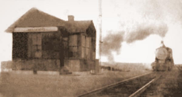
Red Desert Station, 1907.
About 1935, Frank "Wild Horse" Robbins, brother of famed rodeo cowboy "Skeeter Bill" Robbins, began capturing wild horses in the Red Desert. At the
time wild horses were seen in southern Wyoming ranging from the Colorado border up to Pinedale. As previously note,
wild horses were also seen near Meeteetse and in the Pryor Mounains.
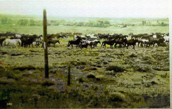
Wild Horses near Pinedale, 1930's, G. B. Dobson, from photo by William P. Sanborn.
Robbins continued to capture throughout the War. He would set up camps in a remote area of the
Red Desert frequented by the wild horses. Using the camp as a base of operations he
would construct traps using railroad ties set in holes dug with a post hole digger.
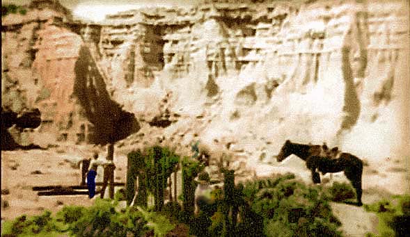
Building a wild horse trap near Laney Rim, 1946.
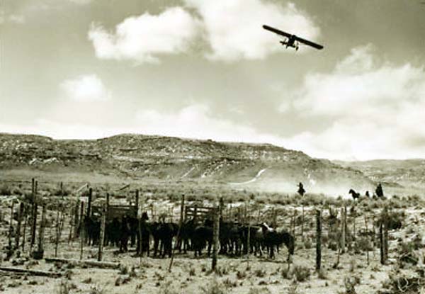
By 1945, Robbins was utilizing an airplane to haze the horses toward "traps" that were constructed leading into
box canyons in the Laney Rim escarpment. However, following the 1945 season, his pilot Walt Williams of Laramie hung up his
spurs. Howard Schrum, "the flying cowboy" would replace him after he was released from the
Army-Air Corps.
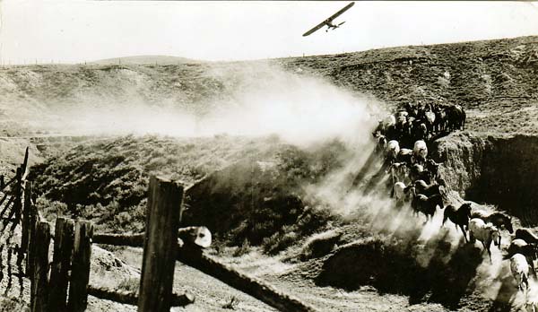
Use of airplane to haze horses, 1946.
In 1945, Verne Woods, a Rawlins photographer accompanied Robbins out to the Laney Rim. That year, Robbins captured a
palamino. The year before Robbins had run into a palomino that was a leader of a band of horses. Verne got a number of photographs of
Robbins in action including one of the Palomino that ran in the Denver Post. The Denver Post article was picked up nationwide by
United Press. The black and white photo was used by Robbins to promote his rodeo held every year at Glenrock.
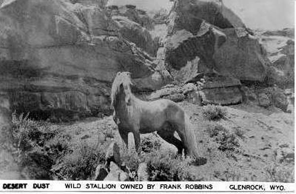
Desert Dust, 1945.
Th following year, Universal-International filmed a short about Frank Robbins and the caputure of
horses. With the publicity a number of artists used the photo as the basis for a variety of paintings.
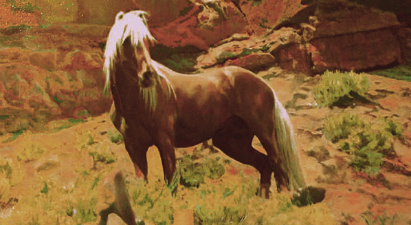
Painting of Desert Dust, 1945.
Desert Dust was murdered in 1952. His killer has never been caught.
Captured horses in corral 1946, airplane used as hazer above.

Robbins' Camp near completed fence, 1946.
For several additional photos of Desert Dust and Frank Robbins see
Frontier Days. Annual wild horse roundup are still conducted in the Red Desert. Today,
helicopters are used as hazers.
Next Page, Cattle Trails in Australia and the Yukon.
|