|
|
|
About This Site |
|
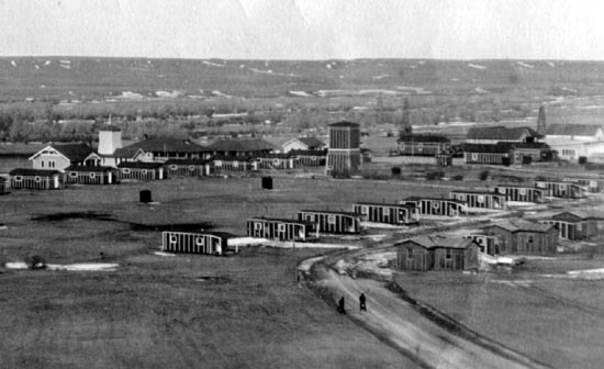 McFadden, Wyoming 1919, looking northwestward. Rock Creek lies west of the town. All photos this page courtesy Trevis Vanlandingham. The Salt Creek Field was not the only area in which the Ohio Oil Company had an interest. About May, 1918, the Company brought in a well on the Cooper Ranch about 12 miles southwest of Rock River, Wyoming. Initially, the camp was known as "Ohio City." In 1920 the camp's name was changed to McFadyen and later to McFadden after John "Uncle Jack" McFadyen (1871-1943), Rocky Mountain General Manager and later a vice-president for the Ohio Oil Company.
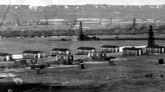 Housing, McFadden, Wyoming, 1919, looking west toward Rock Creek, the Hay Meadows and Foote Creek Rim. Jack McFadyen came to Wyoming from Ohio and worked in the Company's operations in Park, Hot Springs, and Washakie Counties. Pursuant to powers of attorney, placer oil claims were filed by McFadyen during the 1920's in the names of McFadyen and other executives of the company including its president Otto D. Donnell, its chief geologist, Dr. Charles J. Hares, and engineer Mark D. Woolery. The initial well at the Cooper Ranch was, however, drilled under a "producer's lease."
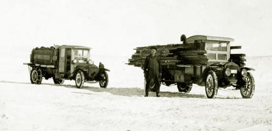 Supply trucks, approx. 1920. Drilling supplies were brought in by motor truck on a dirt road from the railroad at Rock River. Differences arose between the Cooper interests and the oil company in which the Coopers accused the company of "draining" more than four million barrels of oil from the Cooper property to wells on adjacent lands. Well Number 10 on the Cooper property drilled in 1922 was a "gasser" which produced about 15,000,000 feet of gas. When the well came, in production of oil on adjoining wells stopped or decreased and new wells were drilled on adjoining tracts. The Coopers sued. They lost. The court found from geological evidence that oil from the adjoining lands did not come from beneath the Cooper property.
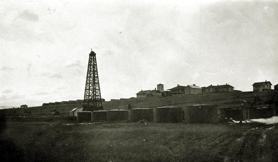 Oil Tanks, McFadden. As will be observed from the photos, the town was located on top of a ridge. The town originally consisted of tar paper houses, a cook house, two schools, and a community center. As will also be observed, the structures at first had no inside plumbing.
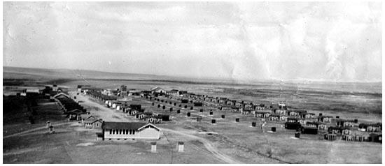 McFadden, 1923, looking north. The two buildings closest to the viewer are the two schools. The elementary school is the smaller of the two buildings. Note the girls and boys facilities behind the buildings. See next photo.
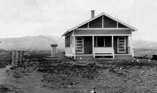 McFadden School, grades 1 through 8. The girls' privy is visible behind the building. The closer structure houses the fire hydrant.
 McFadden Cookhouse. Gradually by 1941, the tar paper shacks were replaced with modern houses with electricity, inside plumbing, and central heat provided by the boiler house below the hill.
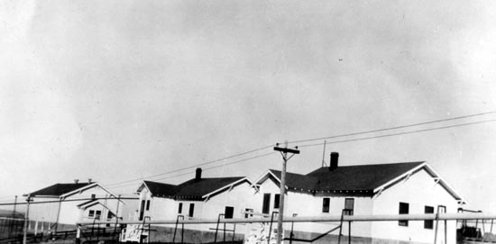 Community Hall on left, two newer houses on right. The pipe in the foreground provides steam for central heating to the houses.
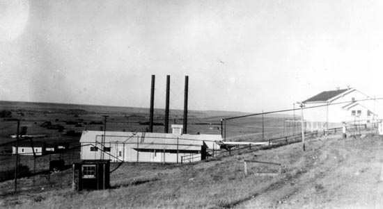 Boiler House on left and Community Hall at top of hill.
 McFadden, looking east across Hay Meadows and Rock Creek, approx. 1941, photo by Wm. P. Sanborn. The scene is now occuppied by the Sims Ranch and is the center piece of a battle between ranching interests and environmentalists. The town, itself, is gone.
The Last Rose of Summer
'Tis the last rose of summer,
I'll not leave thee, thou lone one,
So soon may I follow
|

