|
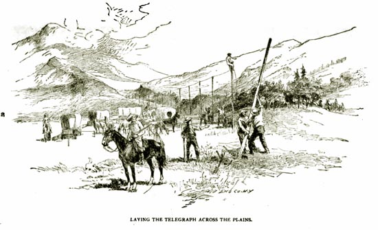
Laying the Telegraph Line across the plains
Although President Lincoln expressed doubts, in light of Indian attacks, that it would be possible to
connect California to the rest of the nation by telegraph, the next great enterprise was commenced.
Construction began on the Fourth of July, 1861. From Omaha, Edward Creighton and his crews headed west. From the Mormom metropolis, W. H. Stebbins began
stretching lines eastward. From Sacramento, 228 head of oxen, 26 wagons and 50 men left Sacramento heading to
Carson Valley.
In what was to become Wyoming, telegraph stations were located at Fort Laramie, Horseshoe, Pacific Springs, and
Fort Bridger.
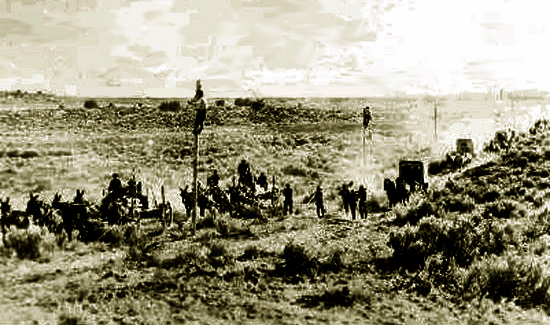
Telegraph Line under construction 1861
On October 25, the telegraph in the
War Department clattered out a message:
United States Military Telegraph
Received 3.30 P M Oct 25, 1861.
From Sacramento 7.40 PM Oct 24th
To: Abraham Lincoln
In the temporary absence of the Governor of the State I am requested to
send you the first message which will be transmitted over the wires of
the telegraph Line which Connect the Pacific with the Atlantic States the
People of California desire to Congratulate you upon the Completion of the
great work.
They believe that it will be the means of stengthening the attachment
which bind both the East & West to the Union & they desire in this the first message across the continent to express their loyalty to that Union & their determination to stand by the Government in this its day of trial They regard that Government with affection & will adhere to it under all fortunes
Stephen J Field
Chief Justice of
California
Note, the message took almost 17 hours to cross the continent. The reason is that the electrical current
fades with distance and, thus, the message was required to be taken down and relayed from station to
station. Nevertheless and in contrast, in December 1859, it took seventeen days and twelve hours to transmit
to California a copy of President Buchanan's message to Congress.
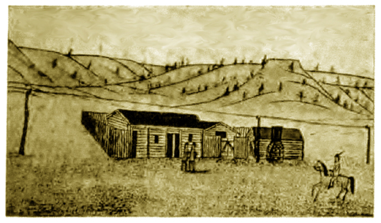
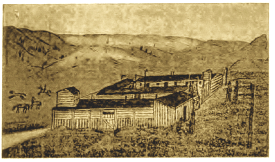
Horseshoe Station, 1863, from a drawing by Carl F. Moellman
Horseshoe Station was located near present-day Glendo. Although, the stage line moved further south to avoid
Indians, it was still necessary for the telegraph stations to be protected by the military. Each became a small
fortified cantonment. Horseshoe Station was burned by Indians in 1866.
The Moellman drawings on this page and elsewhere on this site were drawn by Carl F. Moellman (1844-1902) who enlisted in the
11th Ohio Cavalry (Volunteers) from Hillsboro, Ohio, in 1863. Moellman was born in Prussia. In Wyoming,
Moellman was primarily stationed at Fort Laramie. After the end of
the Civil War, Moellman returned to Ohio where he became an artist and lithographer. The Eleventh Ohio
Cavalry was organized by Col. William
Oliver Collins after whom Fort Collins, Colorado, was named. Col. Collins' son, Caspar Wever Collins,
after whom Casper, Wyoming is named, enlisted at the same time as Moellman. Following the death of
Caspar Collins, the drawings by Moellman came into the possession of Josephine "Josie" Collins, Caspar Collins'
sister. Josephine gave them to John C. Friend who was also a member of the Eleventh Ohio and who enlisted at
the same time as Caspar Collins. Friend participated in the battles near the Platte River Bridge at
which Caspar Collins was killed. John C. Friend gave them to Dr. Grace Raymond Hebard who published them with E. A. Brininstool
in their Bozeman Trail, Arthur H. Clark Company, Chicago, 1922, from which they have been scanned.
Dr. Hebard in the introduction to The Bozeman Trail indicates that they are the only known
contemporaneous illustrations of many of the stations.
The original drawings are held by the University of Wyoming.
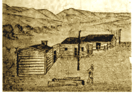
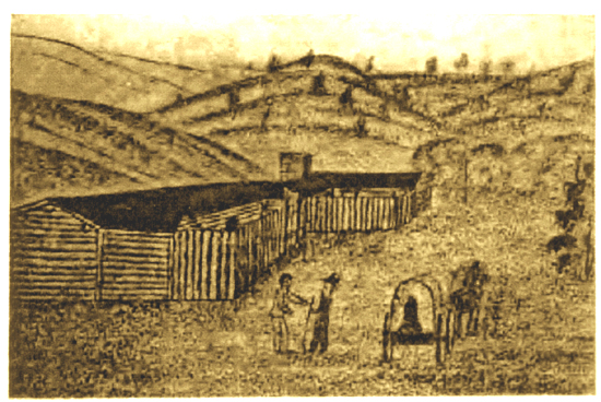
Rocky Ridge Station, 1863, from a drawing by Carl F. Moellman
Rocky Ridge Station is one whose location has been lost in the fog of history. There is no agreement as
to its location. It was located someplace west of Three Crossing Station and east of of South Pass. Allegedly,
it was the location where division superintendent Joseph A Slade killed Jules Benji, after whom Julesburg, Colorado is named, by tying Benji to a
post in the station corral and through the night using Benji for target practice. See The Overland
Stage.
Sweetwater Station, 1863, from a drawing by Carl F. Moellman
Sweetwater Station was about 2 miles to the northeast of Independence Rock.
Notwithstanding, the closure of the Pony Express, the various stations remained open for a time as
telegraph and stage stations and as small military posts in which small detachments of soldier were
stationed to guard the vital link to California.
In the early 1860's as discussed on the subsequent pages, Indian attacks became more frequent on
the stage and telegraph stations along the Oregon Trail. One former pony express rider, William
F. Cody, later observed:
About the middle of September the Indians became very troublesome on the line of the stage road
along the Sweetwater. Between Split Rock and Three Crossings they robbed a stage, killed the
driver and two passengers, and badly wounded Lieut. Flowers, the assistant division agent.
The red-skinned thieves also drove off the stock from the different stations, and were
continually lying in wait for the passing stages and pony express riders, so that we had to
take many desperate chances in running the gauntlet.
The Indians had now become so bad and had stolen so much stock that it was decided to
stop the pony express for at least six weeks, and to run the stages only occasionally during
that period; in fact, it would have been almost impossible to have continued the enterprise
much longer without restocking the line.
As a result after Ben Holladay took over the Overland Stage Line, the trail was moved further south and the
old Oregon Trail was essentially abandoned for civilian use in favor of the Overland Trail and the
Cherokee Trail discussed on later pages. Military units, nevertheless, were required to protect the telegraph line along the
old Emigrants Road.
Three Crossing Station, 1863, from a drawing by Carl F. Moellman
Three Crossing Station took its name in that within one and a half miles of the station, one crossed
the Sweetwater three times. It was located about 18 miles northwest of Independence Rock.
Next page: Indian dependence upon the bison, the coming of the horse.
|