|
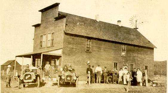
Automobilists, Medicine Bow, approx. 1910
Wister in Chapter 2 of The Virginian, introduced his reader to Medicine Bow:
Medicine Bow was my first, and I took its dimensions, twenty-nine buildings in all,--one coal shute,
one water tank, the station, one store, two eating-houses, one billiard hall,
two tool-houses, one feed stable, and twelve others that for one reason and
another I shall not name Yet this wretched husk of squalor spent thought upon appearances;
many houses in it wore a false front to seem as if they were two stories high.
There they stood, rearing their pitiful masquerade amid a fringe of old
tin cans, while at their very doors began a world of crystal light, a land
without end, a space across which Noah and Adam might come straight from Genesis.
Into that space went wandering a road, over a hill and down out of sight, and up again
smaller in the distance, and down once more, and up once more, straining
the eyes, and so away.
Wister shows the same inventory in his diary for July, 1885, however, omitting in the above
references to the ladies and gents "walks" where standing on the seat was not a luxury but a
necessity. Perhaps, Wister's jaded view of Medicine Bow was influenced by his having
to sleep on the counter in the store, a scene which he also used in the novel:
July 21st
I slept from ten to twelve thirty on the counter of the store at Medicine Bow
and then the train came in bringing the lawyer and the fish--and
after much business talk and lifting tin cans we started off across the
plains at two o'clock....
But certainly, the coming of the Lincoln Highway, except for the addition of Gus Grimm's hotel, did little
to change the description of the town from 1885. The 1916, Complete Official Guide described
Medicine Bow:
MEDICINE BOW
N.Y . . . S.F. .> Pop. 150. Alt. 6,565 feet. Carbon County.
2072 . 1259 . Two hotels, 1 garage. Route marked through town and county;
signs of approach of town. One railroad crossing at grade, not protected. One bank, 1 express company, 1 telephone
company, 1 public school.
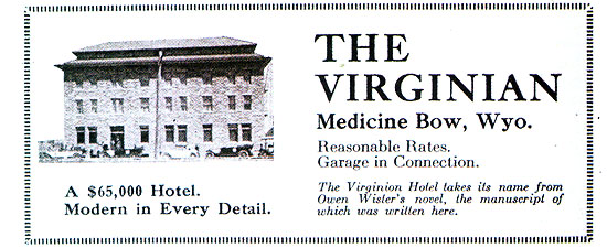 Camp site, good trout fishing. Local Consul, Gus Grimm.
The Virginan Hotel takes its name from Owen Sister's novel of that
name, the manuscript have been written here.
Road marked at this point for Yellowstone Park. Good roads are reported. Ask L. H. Consul as to road conditions.
Fifty miles to the northeast lies Laramie Peak (11,000 ft.) and 20 miles to the sourhwest is Elk Moutain
(11,162 ft.) which can be seen from the Highway all the way to Hanna and Fort Fred Steel.
It may be argued, that Gus Grimm would not have constructed a $65,000 hotel unless he was fairly sure that the highway was
coming his way. Indeed, he was the local consul for the Lincoln Highway Association. At a meeting in
Rawlins, Grimm noted that he represented the towns of Bosler, Medicine Bow and Rock River; that these three small towns with
flourishing good roads clubs, a little elvow grease and liberal donations had built a turnpike road from the eastern
Carbon county line to Rock River. In actuality, the "liberal donations" consisted of an expenditure of
$30,000 by Albany and Carbon Counties to put the road in order. In contrast Elk Mountain spend only a few hundred dollars raised from contributions of
$2.00 apiece from the citizenry. When it appeared that the Lincoln Highway Association might be leaning toward the
Elks Mountain route, Gus Grimm headed off to Detroit to tell the President of the Lincoln Highway Association Henry Joy the facts of life. The Carbon
County and Albany County Commissioners declared that they would not spend a dollar on the Elk Mountain road. Joy was "urged" to incorporate
the Medicine Bow road as a part of the Lincoln Highway through Wyoming. The county constructed road, Grimm reported,
is graded through Cooper lake and is one of the
best in the state.
Thus, it would appear that with the Lord sending a cloudburst and Gus Grimm protecting his
hotel, the cards were stacked against Elk Mountain.
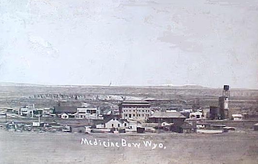
Medicine Bow, 1917.
The Mercantile in which Wister took his nap is the building in the center of the photo. See next
photo.
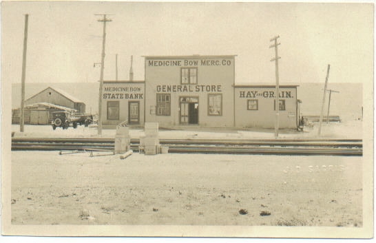
Medicine Bow, 1920's, photo by J. D. Sagris.
In the 1920's, Medicine Bow had
two banks, two hotels, two garages and a population of approximately 300. The store moved in 1931 to the Mercantile
Building depicted in the next photo and the bank moved to the building that presently houses the post office.
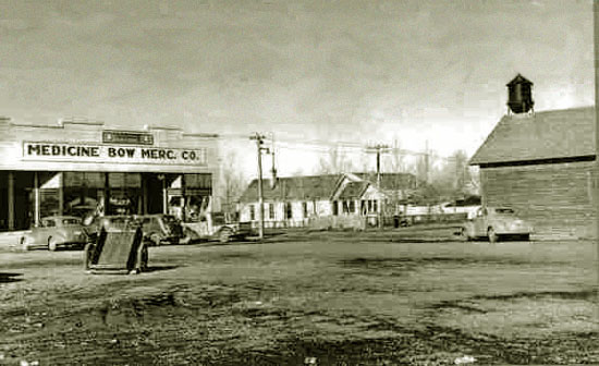
Medicine Bow Mercantile, 1940.
By 1940, Medicine Bow achieved a population of 338. It, however, based on the next photo, that
that it had hardly changed from Wister's time. It was still a town of false fronted buildings and muddy
streets.
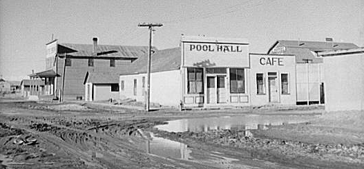
Medicine Bow, March, 1940, photo by Arthur Rothstein
Arthur Rothstein (1914-1985) was a photographer for the
Federal Resettlement Administration, later the Farm Security Administration,
from 1935 until 1940. He was most famous for his depiction of the Oklahoma
Dust Bowl with his 1936 Fleeing a Dust Storm depicting a farmer and his
two sons in front of a shack in an Oklahoma dust storm. The photo the following
year was featured in the Metropolitan Museum of Modern Art. Some controversy,
however, developed over at least one photo in which he was accused of making
conditions appear worse than they really were in order to assist with New Deal Legislation.
In the particular instance he moved a cow skull ten feet. For the remainder of
his life he regretted the photo.
Medicine Bow continued on next page.
|