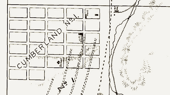
Plat of Cumberland No. 1, 1903. All images
of Cumberland on this page
courtesy of Anadarko Petroleum Corporation.
In addition to schools, a public hall, and the company store, Cumberland had two churches consisting of
a Mormon Meeting House and a Catholic Church.
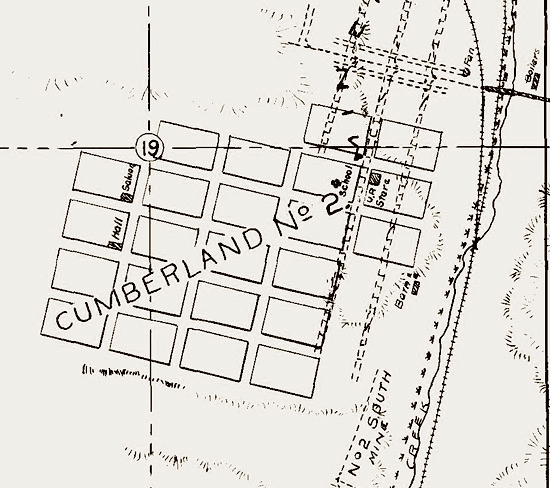
Plat of Cumberland No. 2, 1903.
There were as many as 25 mines in the Cumberland area. Today, all that is left are the remains of the
Ziller Ranch, a saloon in Cumberland Gap, and the Cumberland Cemetery to the north of where Cumberland
No. 2 was located.
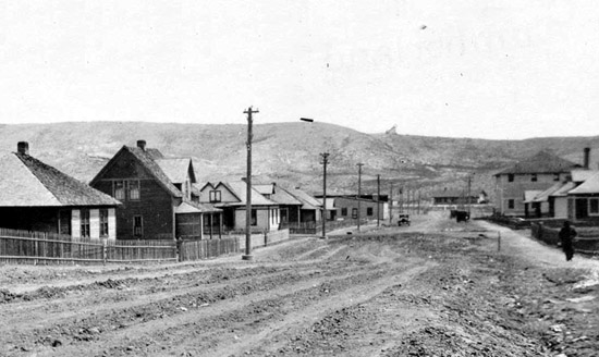
Cumberland (believed Cumberland No. 1) looking east. Company
Store on right. Approx 1929.
Note from the plats that the Company provided schools and public halls. Different coal companies had different attitudes relating
to the quality of amenities provided the employees and the attitude towards the
open towns. Thus, as observed on a subsequent page, the Union Pacific Coal Company actually provided
utility service to White City, adjacent to the Company-owned town of Superior. Miners in Union Pacific towns were
represented by the United Mine Workers who, as noted on a previous page, were established in Wyoming in the
1890's. Other companies, particularly the Colorado
Fuel and Iron Company, discussed on the next page, controlled by John D. Rockefeller, Jr. in southern Colorado, were less beneficent.
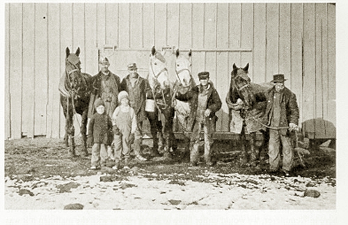
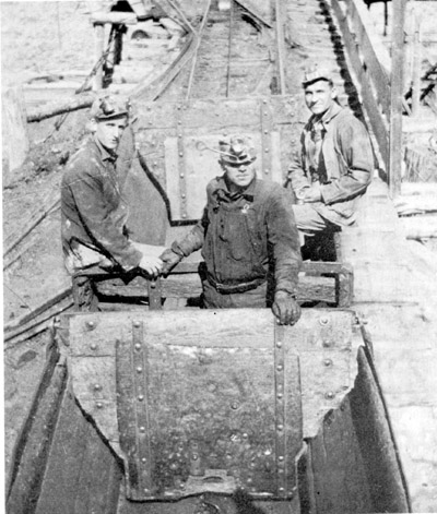 Cumberland Miners
The presence of coal in the Cumberland area
was known as early as 1843 when it was discovered on Brevet Captain John C. Fremont's second expedition (1843-1844). Fremond in his
1845 Report of the Exploring Expeditin to the Rocky Mountains in the
Year 1842, and to Oregon and North California in the Years 1843-44 described the area and finding coal in what is
believed to be Cumberland Gap, in August 1843:
19th.
-- Desirous to avoid every delay not absolutely necessary, I sent on
[Kit] Carson in advance to Fort Hall this morning, to make arrangements for a small
supply of provisions. A few miles from our encampment, the road entered a
high ridge, which the trappers called the "little mountain," connecting
the Utah with the Wind Biver chain; and in one of the hills near which we
passed I remarked strata of a conglomerate formation, fragments of which
were scattered over the surface. We crossed a ridge of this conglomerate,
the road passing near a grove of low cedar, and descending upon one of the
heads of Ham's fork, called Muddy, where we made our mid-day halt. In the
river hills at this place, I discovered strata of fossiliferous rock,
having an oolitic structure, which, in connection with the neighboring
strata, authorize us to believe that here, on the west side of the Rocky
mountains, we find repeated the
modern formations of Great Britain and Europe, which have hitherto been
wanting to complete the system of North American geology.
In the afternoon we continued our road, and searching among the hills a
few miles up the stream, and on the same bank, I discovered, among the
alternate beds of coal and clay, a stratum of white indurated clay,
containing very clear and beautiful impressions of vegetable remains.
This was the most interesting fossil locality I had met in the country,
and I deeply regretted that time did not permit me to remain a day or two
in the vicinity; but I could not anticipate the delays to which I might be
exposed in the course of our journey -- or, rather, I knew that they were
many and inevitable; and after remaining here only about an hour, I hurried
off, loaded with as many specimens as I could conveniently carry.
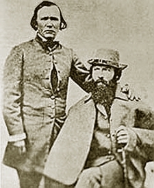 Kit Carson and John C. Fremont
Coal made its appearance occasionally in the hills during the afternoon,
and was displayed in rabbit burrows in a kind of gap, through which we
passed over some high hills, and we descended to make our encampment on
the same stream, where we found but very poor grass. In the evening a fine
cow, with her calf, which had strayed off from some emigrant party, was
found several miles from the road, and brought into camp; and as she gave
an abundance of milk, we enjoyed tonight an excellent cup of coffee. We
traveled to-day 28 miles, and, as has been usual since crossing the Green
river, the road has been very dusty, and the weather smoky and oppressively
hot. Artemisia was characteristic among the few plants.
20th.
-- We continued to travel up the creek by a very gradual ascent and a
very excellent grassy road, passing on the way several small forks of the
stream. The hills here are higher, presenting escarpments of party-colored
and apparently clay rocks, purple, dark-red, and yellow, containing strata
of sandstone and limestone with shells, with a bed of cemented pebbles,
the whole overlaid by beds of limestone. The alternation of red and yellow
gives a bright appearance to the hills, one of which was called by our
people the Rainbow hill, and the character of the country became more
agreeable, and
traveling far more pleasant, as now we found timber and very good grass.
Gradually ascending, we reached the lower level of a bed of white
limestone, lying upon a white clay, on the upper line of which the
whole road is abundantly supplied with beautiful cool springs, gushing
out a foot in breadth and several inches deep, directly from the hill-side.
Writer's note: Mountain men Kit Carson and Thomas "Broken Hand" Fitzpatrick acted as guides
on the expedition. The expedition included 67 mules and horses and one mountain howitzer.
The howitzer was taken over the objection of the Topographic Corps who feared that
its presence in Mexican and British Territories might indicate that the
journey was not strictly for scientific purposes. It may be that the Topographic
Corps' objections were not relayed to Fremont by Fremont's wife, the daughter of
Missouri Senator Thomas Hart Benton. The Expedition was also armed with breech loading rifles, at a
time when standard weapons were muzzel loading. The howitzer was abandoned in the snows of
Nevada. For more on Fremont, see Lander.
Fitzpatrick (1799-1854) was born in Ireland and at age 17 ran away to sea ending up in
New Orleans. He made his way to St. Louis and was a part of the original Ashley Expedition
(See Rendezvous). He later served as guide to
Father DeSmet's journey to Oregon during which DeSmet held Mass at the 1840
Rendezvous near present-day Daniel. Fitzpatrick also served as a scout for Gen. Kearney. Fitzpatrick became
known as "Broken Hand" to the Indians after he lost two fingers of his left
hand when a musket exploded. He is interred in an unmarked grave in Washington, D.C.
Unidentified persons, Cumberland.
Many of the miners in Cumberland - Diamondville - Kemmerer area were from Italy and the Austro-Hungarian
Empire. Indeed, at one time, Cumberland had one of the largest Slovene communities in Wyoming. Many came to Wyoming and
Utah from southern Colorado following the "Ludlow Massacre" discussed on the next page.
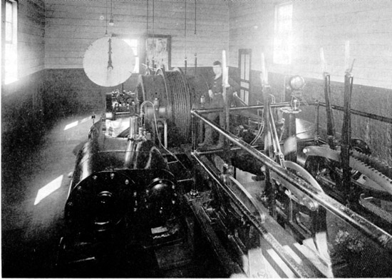
Hoist Room, Cumberland.
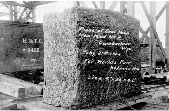
Block of coal from Cumberland displayed at
1904 St. Louis Worlds Fair.
Next Page: Ludlow Massacre.
|